-


Follow Us

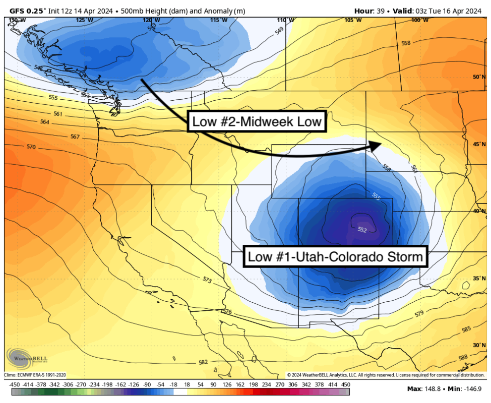
Summer-like temps are being experienced in many areas of the West currently. That is all about to change with the 2 low-pressure systems we are tracking. The first system is currently over the Sierra Range where 1-6 inches fell for Sunday morning favoring the southern regions (China Peak at 6). @
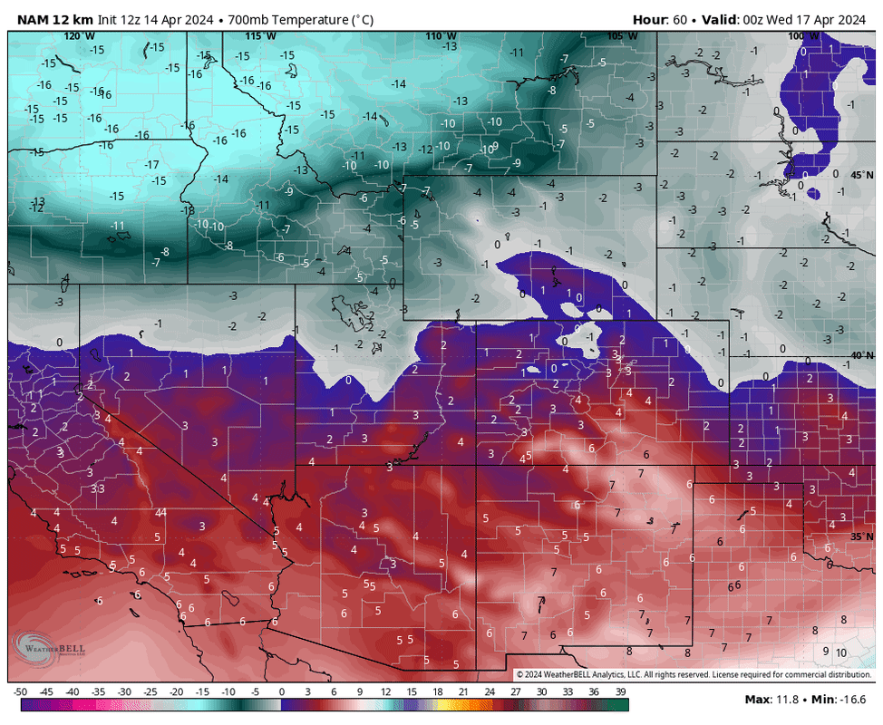
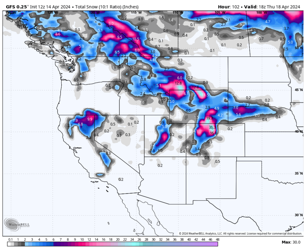
Moisture from the Sierra streams into Utah beginning late Sunday night and will continue into Monday evening. This system will favor central Utah and push north to the Cottonwoods (Salt Lake County) with less snow noted along I-80 or areas of the northern Wasatch. Very warm conditions Sunday (Mid-40s to 50 at Alta) will turn cooler Monday with a weak cold front.
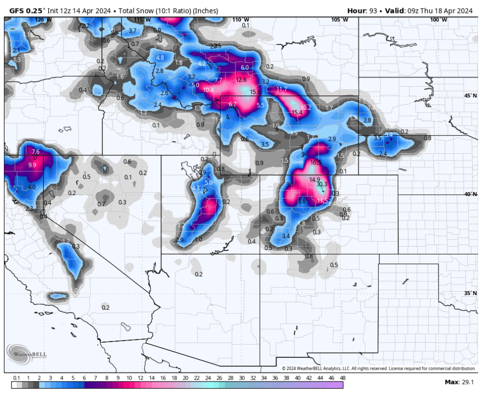
We expect the Cottonwoods to score 9-15 inches by late Monday night. Snow density will be medium to dense which is a good thing to hopefully cover the remains of the slush or chunder from the weekend.
Snowfall increases for Colorado from Late Monday night into Tuesday evening. The models have consistently focussed on the highest totals closer to the Front Range and Divide pushing north towards Larimar County. Resorts such as Winter Park, Loveland, and Berthoud Pass BC zones might score 11-18 inches by Tuesday afternoon. Areas south or west will likely grab lower totals.
NW winds in Colorado can also perform well for Summit County, especially Breckenridge where we expect 6-11 inches. NW winds can also ramp up some totals near Vail Pass or along the central I-70 corridor. Look for some upside here.
Storm #2 enters the west by Tuesday-Wednesday. This system is much colder and impacts interior BC and Alberta before aiming directly at southern Montana for Wednesday morning. As opposed to the system in Utah and Colorado, this system will bring high-quality lower-density powder to areas near Bozeman, especially south (Big Sky, Red Lodge Mountain).
Please follow Powderchasers on FB and Instagram @powderchasers and feel free to send us pics or videos to be published in Powder.
More must-reads:
- MLB rankings: The five most disappointing free-agent signings
- Former NBA player turned podcaster a finalist for Hornets coaching job
- The 'Most career passing touchdowns' quiz
Breaking News
Customize Your Newsletter
 +
+
Get the latest news and rumors, customized to your favorite sports and teams. Emailed daily. Always free!